ASTM Standards
The American Society for Testing and Materials standards and publications.


The American Society for Testing and Materials standards and publications.
A process designed to help engineers to factor climate change impacts into plans for design, operation and maintenance.
The Climate Mapping for Resilience and Adaptation (CMRA) portal, an easily accessible and interactive geospatial website.
A website that provides resources and research on building resilience to climate change.
Research & educational resources on everything earthquakes.
This map shows 2.5+ magnitude Earthquakes that have happened in the past day.

Real-time phone app radar that also shows nearby earthquakes and the local air quality index.

Excerpt from Landslides Hazards – Maps that describes what this resource is a little.

Excerpt from 2021 International Residential Code that describes what this resource is a little.

Excerpt from 2021 International Residential Code that describes what this resource is a little
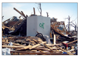
Guidelines and standards for constructing safe rooms for high-wind events like hurricanes and tornadoes.
Real-time phone app radar that also shows nearby earthquakes and the local air quality index.

An article by a reinsurer that discusses how investment in nature can help to mitigate flood risk.
World class center for multi-disciplinary disaster prevention research & communication.
Guidelines and standards for constructing safe rooms for high-wind events like hurricanes and tornadoes.
World class center for multi-disciplinary disaster prevention research & communication.
A resource to guide homeowners towards improving the likelihood of their home surviving a wildfire.

US Government air quality index data combined with a map of wildfires.
Real-time phone app radar that also shows nearby earthquakes and the local air quality index.